ERG Develops Innovative Technique to Estimate Air Emissions from Helicopters
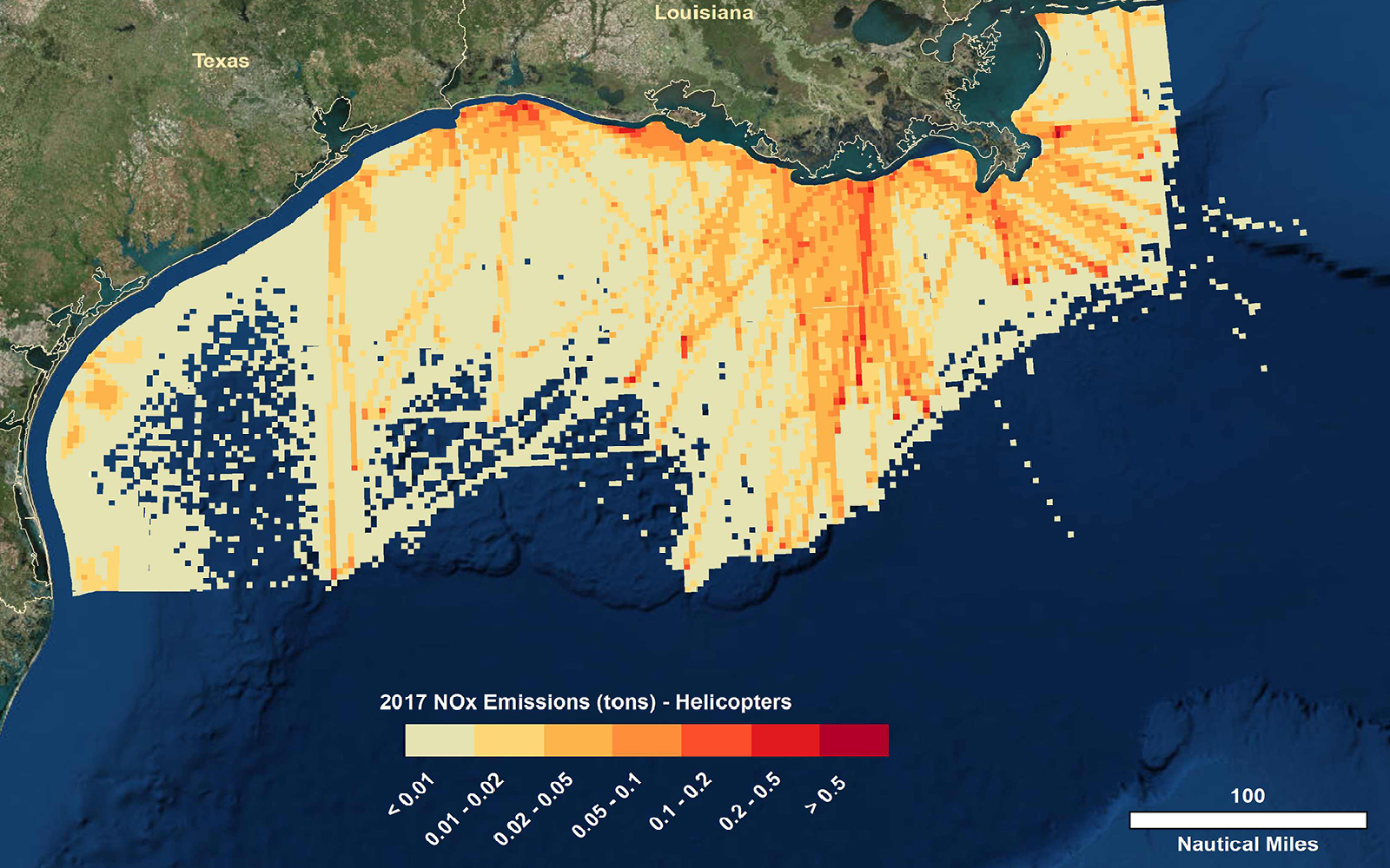
ERG has developed an innovative technique for the Bureau of Ocean Energy Management to estimate criteria pollutant and greenhouse gas emissions from helicopters. Using new aircraft satellite tracking data from the Federal Aviation Administration’s NextGen air traffic system, the technique accurately maps helicopter operations in the Gulf of Mexico based on the latitude and longitude coordinates of the transmitted signals. ERG aggregated satellite observations in five-minute flight durations, then applied them to helicopter emission factors developed specifically for the oil and gas support fleet in the Gulf of Mexico. We also used GIS to visualize aggregated traffic patterns, noting locations where helicopter activities and emissions are highest. ERG presented this method as a poster at the January 2020 Transportation Research Board conference.