Western Rivers and Streams Assessment
Project Brief
The Challenge
The Western Rivers and Streams Assessment (WRSA) is a survey designed to evaluate the status, condition, and trends of streams and rivers managed by the Bureau of Land Management (BLM). As part of BLM’s Assessment, Inventory, and Monitoring (AIM) strategy, ERG was contracted to support sampling efforts in extremely remote aquatic environments accessible only by boat across the western United States. ERG collected reliable data to inform stream management decisions and monitor the health and condition of these hard-to-reach river and stream segments.
ERG's Solution
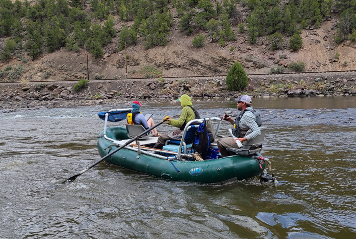
ERG conducted over 60 aquatic assessments across BLM-managed lands in Arizona, California, Colorado, New Mexico, Utah, Nevada, Montana, Oregon, and Idaho. Boating crews performed a range of fieldwork, including water quality sampling, macroinvertebrate collection, geomorphological assessments, riparian vegetation identification, and evaluations of bankfull, streambank stability, angle, and structure. Fieldwork often required navigating remote areas and challenging Class IV rapids, underscoring the demanding nature of the sampling efforts. Data were collected using tablets equipped with Survey123 and other GIS-based platforms to ensure accurate and efficient field data capture. The resulting datasets support BLM’s stream management strategies by identifying the status and trends of aquatic systems and establishing baseline conditions for future comparison.
Client
Bureau of Land Management