Monitoring the San Juan Watershed Following the Gold King Mine Spill
Project Brief
The Challenge
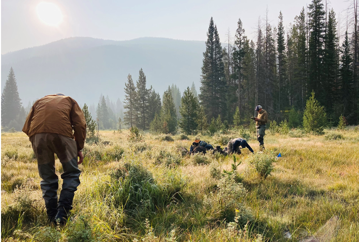
After the 2015 Gold King Mine spill, communities along the San Juan and Animas Rivers needed a clear picture of their watershed’s health. These rivers are essential for ecosystems, agriculture, and people across multiple states and tribal lands, but they face ongoing threats from historic mining contamination and pollutants from nonpoint sources. The U.S. Environmental Protection Agency wanted to create a long-term monitoring program that would track water quality, identify trends, and share reliable information with the public. This would require multi-year biological, chemical, and physical monitoring across a vast watershed; coordination among states, tribes, and private landowners; and the development of tools to make complex data understandable and accessible.
ERG's Solution
ERG supported EPA in creating the San Juan Long Term Monitoring Program by developing detailed sampling and quality assurance plans; securing access to sites; and conducting multi-year monitoring of water quality, sediment, and biological health across the watershed. Our team managed every step of the data process—from collection and quality control to uploading results to EPA’s Water Quality Exchange. We built custom analytics to model runoff trends and guide sampling schedules, and we transformed raw data into interactive tools for the public that included GIS map books, a watershed-wide story map, and a web-based interactive map published on EPA’s site that links users directly to water quality data. We also created fact sheets, reports, and visual resources to keep stakeholders informed. By combining science, technology, and communication, the San Juan Long Term Monitoring Program delivers transparent and meaningful information and guidance to keep local communities informed and help protect the water that they depend on.
Client
U.S. Environmental Protection Agency