Visualizing the Dangers of Storm Surge
Project Brief
The Challenge
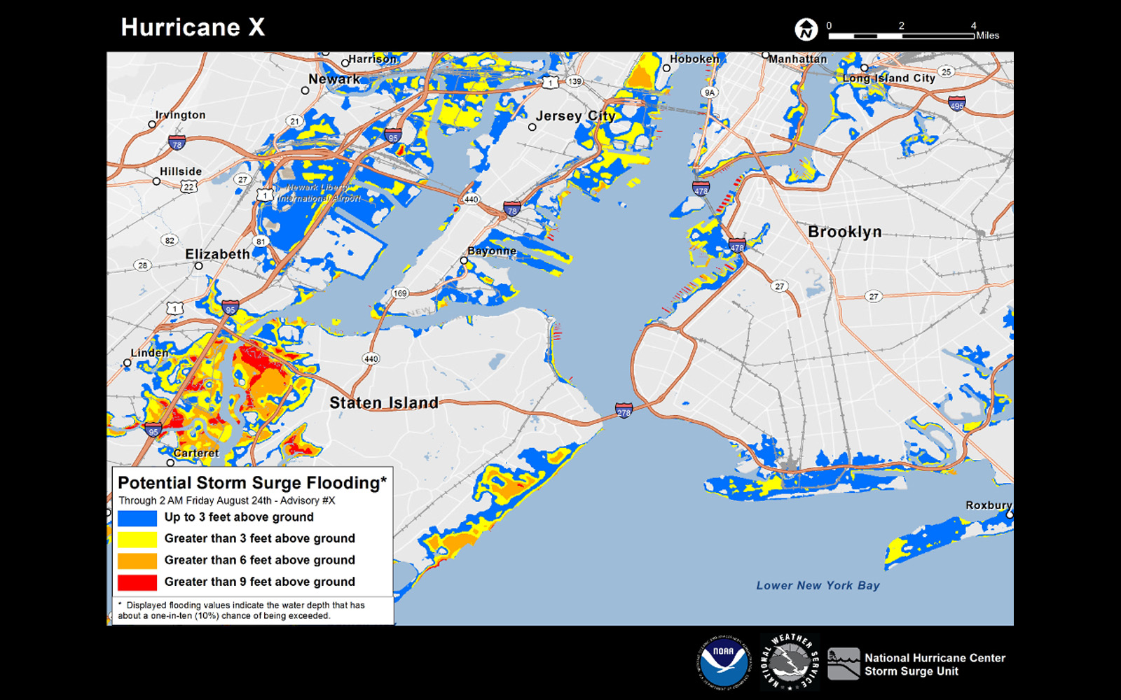
Storm surge is often the number one killer during hurricanes, but a lot of people don’t understand what it is or how dangerous it can be. NOAA’s National Hurricane Center asked for ERG’s support to improve its communication around storm surge so people could better visualize the danger and understand their risk.
ERG's Solution
ERG conducted more than five years of social science research to inform development and refinement of an interactive map that shows where—and how high—water from a hurricane’s surge could reach during a storm. ERG tested prototypes of the map and accompanying messaging with forecasters, emergency managers, members of the media, and the public. ERG also gathered feedback from these same stakeholders after two actual hurricanes to gauge their awareness and use of the map. Collectively, ERG’s work—from primary research to applied product assessment—has provided the National Hurricane Center with an effective risk communication tool matched to the needs of its users.
Client
National Oceanic and Atmospheric Administration